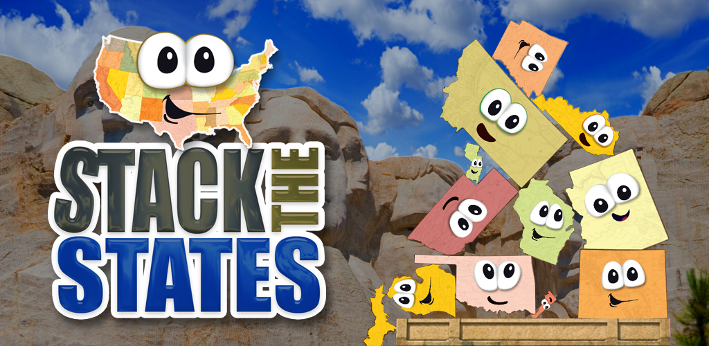
Artifacts from game play.
|
Stack the StatesPlatforms: OS, Windows, and Android mobile devices
Users: Ages 9 and Up, Fun for adults too Cost: 1.99 'Stack the States' is an interactive app that allows you to explore all 50 states of the US. Some of the facts you learn include the following: · Capitals · Shapes of the states · State abbreviations · Borders · Location on map · Nicknames · Flags · Size · Major Cities Learning is reinforced using flash cards, multiple choice quizzes, five different games, and memorization. Users can study information the information first with flash cards or jump into the app by trial and error. As you traverse through the states, you can shift the states and drop them anywhere on the screen. You have to build a stack of states to graduate levels. As you progress, more games are unlocked. |
Benefits |
· Fun graphics and animation
· Users can choose different avatars to represent themselves · Lots of information in one app · Game can be tailored depending on user interest |
Constraints
|
· Games can get challenging as levels increase depending upon user age.
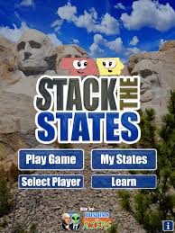
· Controls can be a little sensitive · Vague instructions · Only one subject covered Goal: Build a stack of states high enough to reach checkered line.
1. Answer each question correctly to get a state 2. Tap inside the ring surrounding the state to move it 3. Tap outside the ring to rotate the state 4. Tap the ‘Drop It” icon to release the state onto the pedestal Instructional video of Stack the States by Crazymikesapps.com (hhttps://www.youtube.com/watch?v=v1wFkwWwPXg)
1. Take a field trip to one of the cities mentioned in the app. Use it as a guide to collect historical information since this type of data isn’t included in the game. Have the students create timelines of the historical information. 2. Students can use the app in a social studies class to explore each state as it is covered. 3. Set-up different stations within a classroom or large area (to include other classrooms) and have each station represent a different state. Each station would have a mobile device detailing information about the state. You could also have a ‘governor’ at each station giving out more detailed information and passport stamps into pre- made booklets created by the kids. 4. Students will learn about the states that border their home state. They will learn about customs, similarities/differences, and the region those states are in. Students can infer how nearby states grew their identify geographically. 5. Have the students memorize the states by shape by graphing borders on graph paper. 1.
Teachers can use the app for one on one learning
with students lacking proper geography knowledge.
2. Teacher can demonstrate each state on Google Earth on large monitor as the class progresses through the app. 3. Teacher can use app as a review for geography tests and quizzes. 4. Teacher can create jingles as a way to memorize states using facts from app. 5. Use location information from app to visually demonstrate cardinal directions. |
